


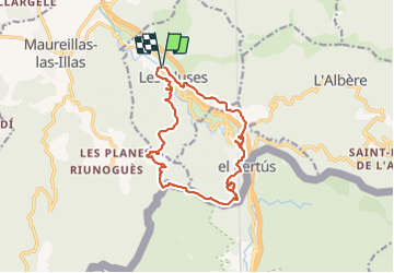
Les Cluses Fort de Bellegarde
© OpenStreetMap contributors


5h57
Difficulty : Medium


Length
16 km
Max alt
491 m
Uphill gradient
606 m
Km-Effort
24 km
Min alt
130 m
Downhill gradient
608 m
Boucle
Yes
Creation date :
2021-07-01 08:37:44.304
Updated on :
2021-07-01 15:27:58.299
5h57
Difficulty : Medium
FREE GPS app for hiking
 SityTrail
IGN / Geographical institutes
SityTrail Plus
The world is yours!
About
Trail Walking of 16 km to be discovered at Occitania, Pyrénées-Orientales, Les Cluses. This trail is proposed by jean.marie.litzler@gmail.com.
Positioning
Country:
France
Region :
Occitania
Department/Province :
Pyrénées-Orientales
Municipality :
Les Cluses
Location:
Unknown
Start:(Dec)
Start:(UTM)
486649 ; 4703752 (31T) N.
Comments